
Tampa Bay Traffic & Commute Guide: Bridges, Rush Hour, Ferries & Transportation
Based on verified data from FDOT, Forward Pinellas, PSTA, HART, and TBRPC.
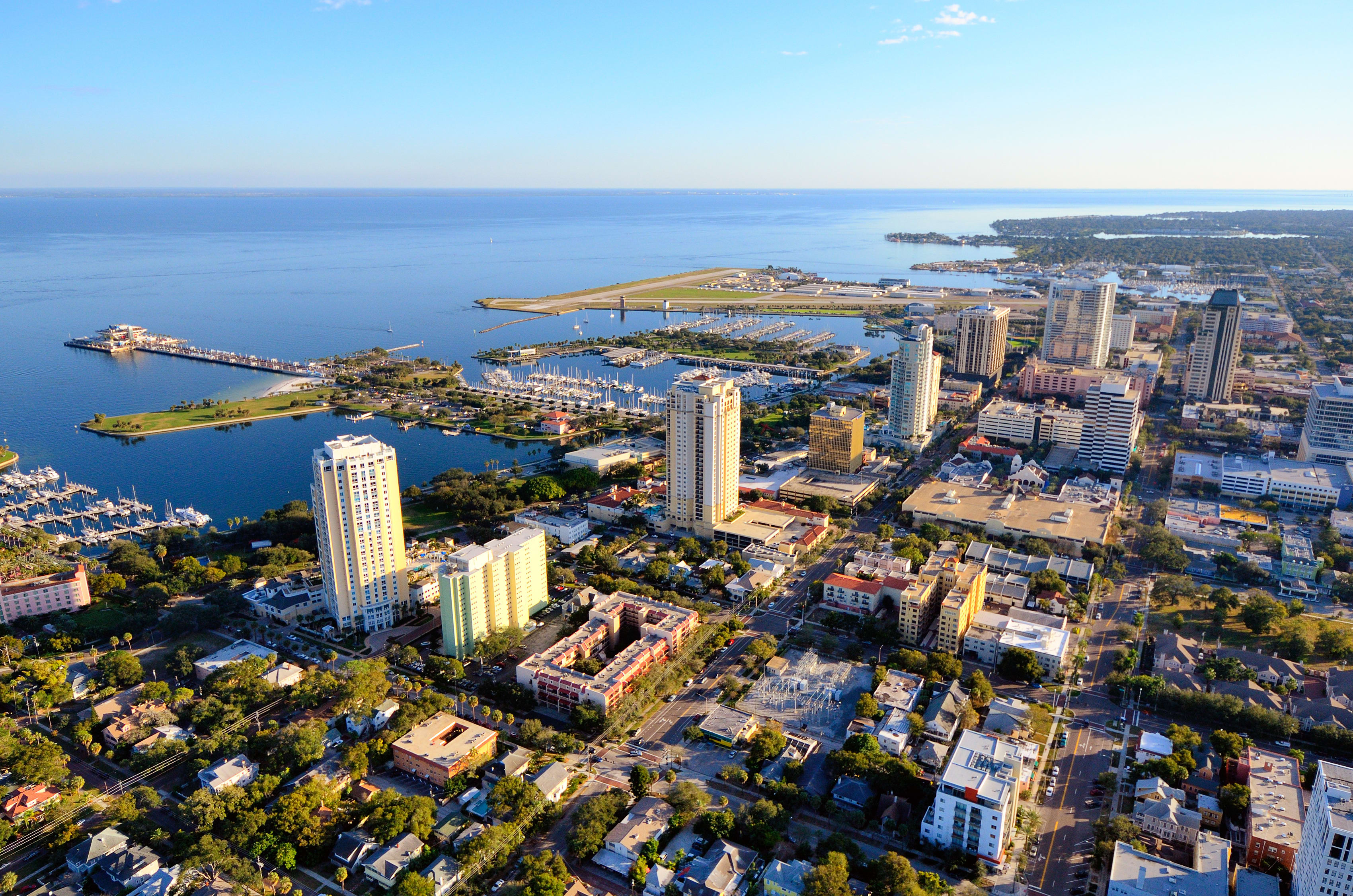
Relocating to Tampa Bay means navigating bridges, ferries, and seasonal traffic flows that shape everyday life. Whether you’re commuting from St. Pete to downtown Tampa or exploring the coast from Clearwater to Dunedin, knowing how to get around can make or break your daily routine — and even influence your home’s value.
Quick Tips for Getting Around Tampa Bay
• Rush hour: 7–9 a.m. & 4:30–6:30 p.m.
• SunPass saves 25% on bridge tolls (Howard Frankland & Gandy).
• Cross-Bay Ferry runs October–May — most popular weekends.
• PSTA & HART accept Flamingo FARE tap card.
• Stadium events (Tropicana Field & Raymond James) can double travel times.
Relocation to Florida
Quick Answer
Tampa Bay rush hour is typically busiest from about 7–9 a.m. and 4:30–6:30 p.m. on weekdays. Traffic is often heaviest on I-275, the Howard Frankland Bridge, Gandy Bridge, Courtney Campbell Causeway, and major routes into Downtown Tampa and St. Petersburg. For commuters and relocating buyers, where you live relative to these bridges can significantly affect daily drive times.
🚗 Major Bridges & Highways
Tampa Bay’s geography revolves around its waterways, making bridges the arteries of daily life. The Howard Frankland Bridge (I-275) carries 170 000+ vehicles daily (FDOT), linking St. Petersburg to Tampa in about 30 minutes outside rush hour. The Gandy Bridge offers a more scenic alternative for local drivers, while the Courtney Campbell Causeway connects Clearwater to Tampa with bike lanes and sunset views.
SunPass toll sensors are required on most expressways and save roughly 25 % versus pay-by-plate rates.
- St. Pete → Downtown Tampa (via Howard Frankland): 35–45 minutes AM peak
- Clearwater → Tampa (via Courtney Campbell): 40–50 minutes
- Gulf Beaches → St. Pete Downtown: 25–35 minutes
🚦 Live Traffic Resources for Tampa Bay Commuters
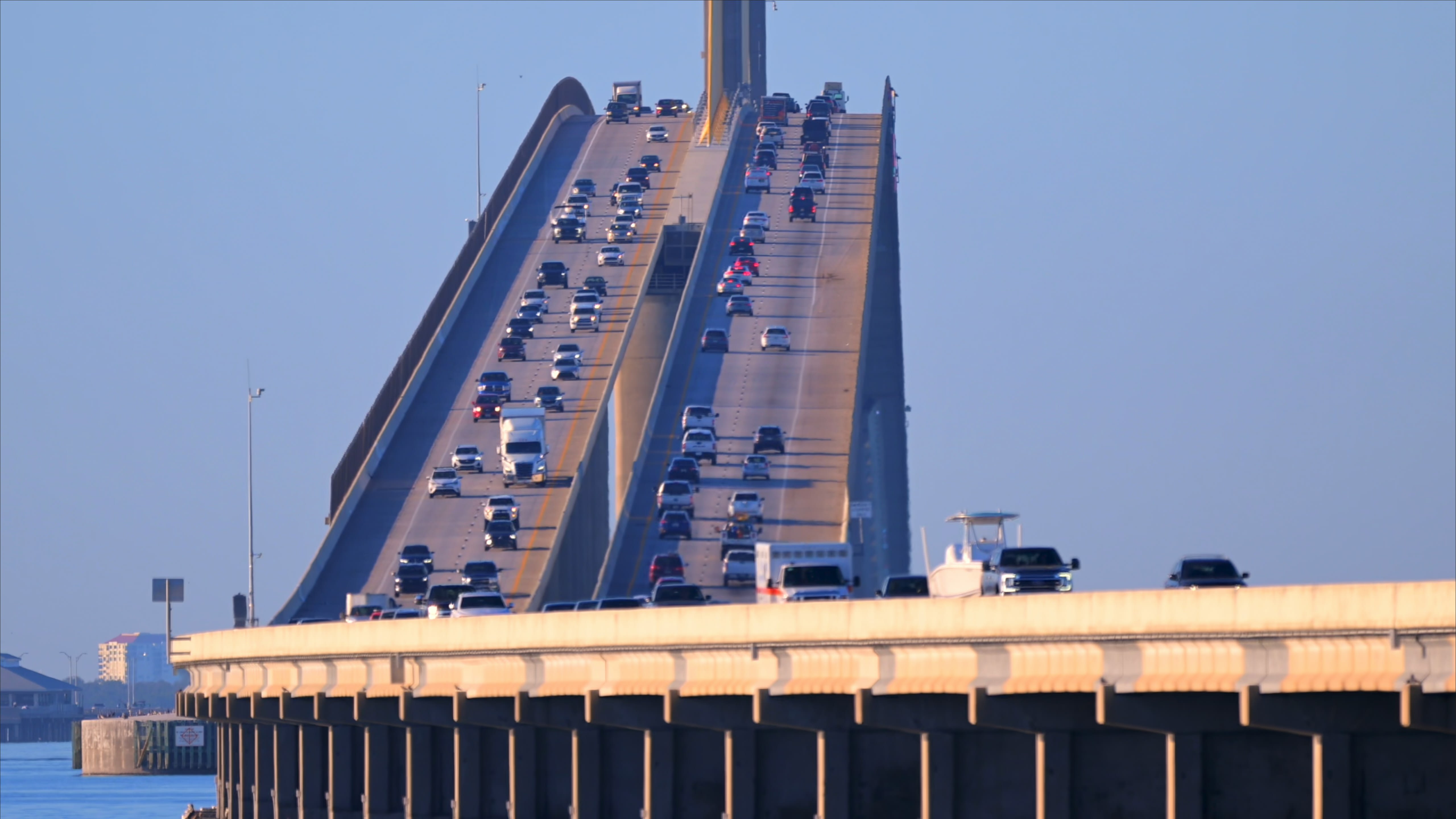
Traffic conditions can change quickly across Tampa Bay, especially on the Howard Frankland Bridge, Gandy Bridge, Courtney Campbell Causeway, Sunshine Skyway Bridge, and I-275. Before choosing a neighborhood or planning a commute, these resources can help you monitor real-time traffic conditions.
Many relocating buyers search for terms like Howard Frankland Bridge traffic now, Gandy Bridge traffic now, Skyway Bridge traffic today, I-275 traffic now, Tampa traffic accidents today, and St. Petersburg traffic conditions. Understanding these patterns can help you choose a location that fits your daily lifestyle and commute goals.
Helpful Tampa Bay Traffic Resources
- Florida Highway Patrol Traffic Incidents – Live crash reports, roadblocks, and major traffic incidents throughout Florida.
- FDOT Traffic Information – Statewide traffic conditions, lane closures, construction updates, and transportation information.
- Spectrum Bay News 9 Traffic Center – Tampa Bay traffic cameras, local traffic reports, and construction updates.
- Google Maps – Real-time traffic conditions, alternate routes, and estimated travel times.
- Waze Live Map – Community-reported traffic alerts, crashes, police activity, hazards, and road closures.
Major Tampa Bay Commute Routes
- Howard Frankland Bridge (I-275) – Primary connection between St. Petersburg and Tampa.
- Gandy Bridge – Popular route between northeast St. Pete and South Tampa.
- Courtney Campbell Causeway – Connects Clearwater and Tampa with access to Tampa International Airport.
- Sunshine Skyway Bridge – Main route between Pinellas County and Manatee/Sarasota Counties.
- I-275 Corridor – One of the busiest commuter routes in the Tampa Bay region.
For buyers relocating to the area, reviewing traffic conditions during your actual commute times can provide a much more realistic picture of daily life than simply measuring distance on a map. A neighborhood that appears only a few miles away may have a significantly different commute experience depending on bridge access, rush-hour traffic, and seasonal congestion patterns.
🚌 Public Transit & Trolleys
The Bay Area runs on two main bus networks: PSTA (Pinellas Suncoast Transit Authority) and HART (Hillsborough Area Regional Transit). Together, they connect Clearwater, Largo, St. Pete, Tampa, and Brandon with dozens of routes using the contactless Flamingo FARE card.
Free local trolleys make short city trips easy — the Downtown Looper in St. Pete and the TECO Line Streetcar between Tampa and Ybor City are favorites for residents and tourists alike (PSTA | HART).
⛴️ Cross-Bay Ferry & Water Taxis
The Cross-Bay Ferry connects downtown Tampa and St. Petersburg from October through May (official schedule), offering a 50-minute ride with Gulf views. Riders can walk or bike onboard, making it a popular alternative to bridge traffic during events or tourist season. In Tampa’s Channelside District, the Pirate Water Taxi runs year-round with 16 stops along the Riverwalk.
🚴 Trails & Bike/Scooter Options
The Bay area offers some of Florida’s best multi-use paths: the Pinellas Trail, Courtney Campbell Trail, and Tampa’s Bayshore Linear Park. Lime and Coast Bike Share operate across Tampa and St. Pete. Helmet laws apply for riders under 16, and headlights/taillights are required after sunset.
📍 Typical Commutes & Local Tips
Traffic peaks weekdays 7–9 a.m. and 4:30–6:30 p.m. Bridges and coastal routes often slow down sooner when rain storms hit in summer. Apps like Google Maps and Waze help drivers avoid construction and stadium delays. Remote workers often choose Palm Harbor, Safety Harbor, or Seminole to stay close to the beaches while avoiding daily bridge commutes.
🌤 Seasonal Traffic Patterns
Tampa Bay traffic varies by season (Forward Pinellas & FDOT):
- Winter (Dec–Feb): Snowbird season and major events drive up volumes on US-19, I-275, and the Howard Frankland. Parking and toll costs increase near beaches and downtowns.
- Spring Break (Mar–Apr): Clearwater and St. Pete Beach gridlock midday and evenings. PSTA adds express routes to handle beach crowds.
- Summer (May–Sep): Lighter tourist traffic but afternoon storms & construction slow interstate lanes. Great season for buyers to house-hunt without seasonal congestion.
- Fall (Oct–Nov): Steady flows return as road projects wrap up before winter. Cross-Bay Ferry resumes service for commuters and events.
Knowing these patterns helps buyers plan closings and sellers schedule showings around peak commute windows.
📚 Related Guides for Pinellas County Buyers
- Cost of Living in Pinellas County
- Relocating to Pinellas County: Moving Tips & Neighborhood Insights
Dive deeper into neighborhoods, flood zones, lifestyle, and local market trends in our Pinellas County Real Estate Resource Center.
🏡 Why Transportation Matters When Buying or Selling
Commute times and bridge access directly impact property values across Tampa Bay. Homes with easy access to I-275, Gandy, or Courtney Campbell often sell faster and retain value longer. For buyers, shorter commutes mean better quality of life. For sellers, highlighting “20-minute access to downtown Tampa or St. Pete” creates a competitive advantage.
Get Your Price & Sale Plan or Book a 30-Minute Call to see how commute factors influence your next move in 2025.

Todd Howard, Realtor® | Charles Rutenberg Realty
GRI • RENE • PSA • SRS • ABR
Serving Pinellas County since 2018
📞 (727) 304-3398 | 📧 toddhowardpa@gmail.com